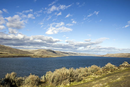
This Place-Based Collaborative aims to address the complex water management challenges in the Columbia River Basin, fostering collaboration among stakeholders to integrate data, reports, and models and explore transformative solutions for community and environmental well-being.

Photo Credit: Bonnie Moreland
Located in the Inland Pacific Northwest, the Columbia River Basin (CRB) and its four main tributaries cover 668,000 km2 and span seven states and one Canadian province. Most of the precipitation in the basin falls as snow in the mountains, augmenting rivers and streams with cool water during hot and dry summer months. Historically, these critical summer flows supported some of the largest salmon runs in the world. Today, the CRB is known for its large tracts of managed forests, its agricultural productivity — including irrigated pastures of tree fruits, grapes, and hops, as well as its field crops, such as dryland wheat and legumes — and as a source of hydropower production. As in many basins, the CRB must support an increasing demand for water. Many of the large cities in the CRB, including Spokane and the TriCities, have experienced dramatic industrial and municipal growth in addition to the large agricultural and environmental demands. Mid-sized and smaller cities and towns are diverse with some highly dependent upon natural resource extraction (e.g., agriculture, forestry, mining, energy), while others are more amenity oriented or diversified. This community heterogeneity and related demographic dynamics brings complexity in terms of needs, opportunities, and contributions in terms of community and environmental wellbeing.
In accommodating these needs and opportunities, the CRB and the river’s tributaries have been heavily modified to include 19 hydropower dams and thousands of kilometers of irrigation canals and runoff drains which create trade-offs across water use sectors. This is especially true as climate changes and environmental disturbances become more common. More frequent and more intense droughts have created increased tensions between water users in the CRB. When streamflow is low, potential impacts include possible shortages for municipal drinking water systems, detrimental crop impacts from curtailment of irrigators with junior water rights, reduced flows available for hydropower production, and warmer stream temperatures that can be lethal for the remaining endangered salmonids that still access the CRB. The region has also seen an increase in wildfire activity, which can destroy important ecosystems and infrastructure, and severely degrade water quality.
Yet, across the CRB, communities are adapting and responding to these changes. Agriculture is seeing efforts to transform to regenerative practices with support from conservation districts, managers and tribes are co-developing innovative solutions for cooling and hydrating streams for fish, and communities are exploring better ways to manage impacts from wildfire and improve their wellbeing in the face of changing climate.
To date, the focus of this group has been on integrating existing data, reports, and models for the CRB while building connections with local stakeholders in the region to identify and potentially partner on collaborative, guided transformations.
Team Members
- Jan Boll (WSU)
- Courtney Flint (USU)
- Brad Gaolach (WSU)
- Sonia Hall (WSU)
- Jessica Schad (USU)
Students
- Kinsey Ayers (WSU)
- Emma Epperson (USU)
- Philip Moffatt (WSU)
- Hailey Smith (WSU)
Publications
- , , , , , , et al; 2024. “ Concurrently Assessing Water Supply and Demand is Critical For Evaluating Vulnerabilities to Climate Change.” JAWRA Journal of the American Water Resources Association 60 (2): 543–571. https://doi.org/10.1111/1752-1688.13192.