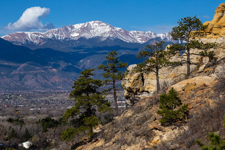
The Front Range Place-Based Collaborative focuses on addressing biophysical changes and water management challenges in the Colorado Front Range corridor, emphasizing resilience following wildfires, impacts of urban expansion, and the colonization of water right law.

Photo Credit: Joel Tonyan
Located on the eastern slopes of the southern Rocky Mountains, the Colorado Front Range (FR) corridor is over 300 km long and contains nearly 5 million people, including the major population centers of Denver, Fort Collins, and Colorado Springs. The FR defines the eastern edge of the IMW and is characterized by an abrupt shift in elevation as the Rocky Mountains rise from the Great Plains, extending from near the Colorado-Wyoming border in the north to the city of Pueblo, CO, in the south. In addition, this region is the headwaters for the South Platte River (~63,000 km2) and its numerous tributaries, including the Cache la Poudre River (Poudre), Big Thompson River, and Boulder Creek, all of which are supplemented by transbasin water deliveries from the western side of the Continental Divide.
Watersheds of the FR are undergoing rapid biophysical change due to extreme stressors exacerbated by climate change, including massive forest die-off from pine beetle infestations, reduced snowpack runoff, and large wildfires. The Poudre and Big Thompson watersheds, in particular, have recently been impacted by numerous wildfire and flooding disturbances, including the Cameron Peak and East Troublesome wildfires and subsequent floods. The Cameron Peak wildfire burned approximately 200,000 acres in 2020 and is the largest fire in Colorado history.
The Front Range Place-Based Collaborative examines numerous topics along a rural-urban gradient, including the colonization of water right law and management (the FR is the birthplace of Western water law), the natural and social resilience of headwater systems following major wildfire disturbances, and impacts of urban expansion on natural river systems. These studies use several approaches, including hydrologic modeling, watershed reforestation studies, and surveys with local governance groups.
Students
- TR Heydman (CSU)
- Griselda Landa-Posas (CSU)
- Mariah Papac (CSU)
- Kayla Schultz (CSU)
- Jamie Woolet (CSU)